{"action":"create","ckan_id":null,"date_created":"Tue, 17 Feb 2026 20:06:12 GMT","date_finished":null,"harvest_job_id":"8c23bd23-7577-45f7-a63f-040daa07c505","harvest_source_id":"f9d00e6f-40cc-4807-b9d1-f656c87735d8","id":"4c32f1d7-6d15-4251-8315-3b678e0b0798","identifier":"https://www.arcgis.com/home/item.html?id=03ca7c06f7924700aa3a01bf22338d83","parent_identifier":null,"source_hash":"f2691ff35f68704c806e69151b22bef3ba3eec7f8f670cbe2891f506574bdbdf","source_raw":"{\"@type\": \"dcat:Dataset\", \"accessLevel\": \"public\", \"contactPoint\": {\"@type\": \"vcard:Contact\", \"fn\": \"University_of_Idaho_Library\", \"hasEmail\": \"mailto:bgodfrey@uidaho.edu\"}, \"description\": \"<div>This collection contains 4 2021 1-centimeter color infrared orthorectified images of four study sites within Castle Rocks State Park, Idaho. These data were acquired in June, 2021. These data are sourced from US NSF Idaho EPSCOR.</div><div><br /></div><div>
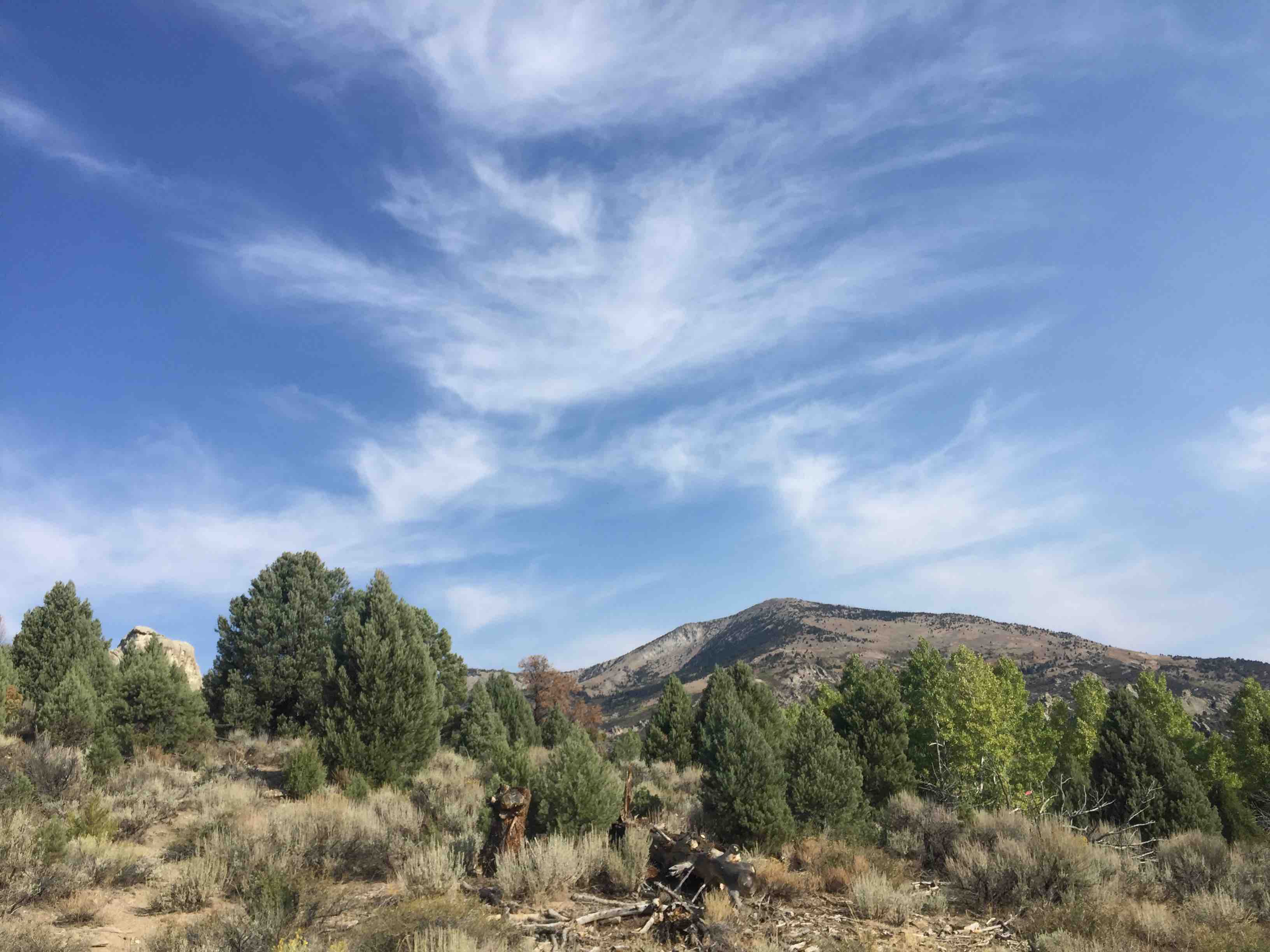
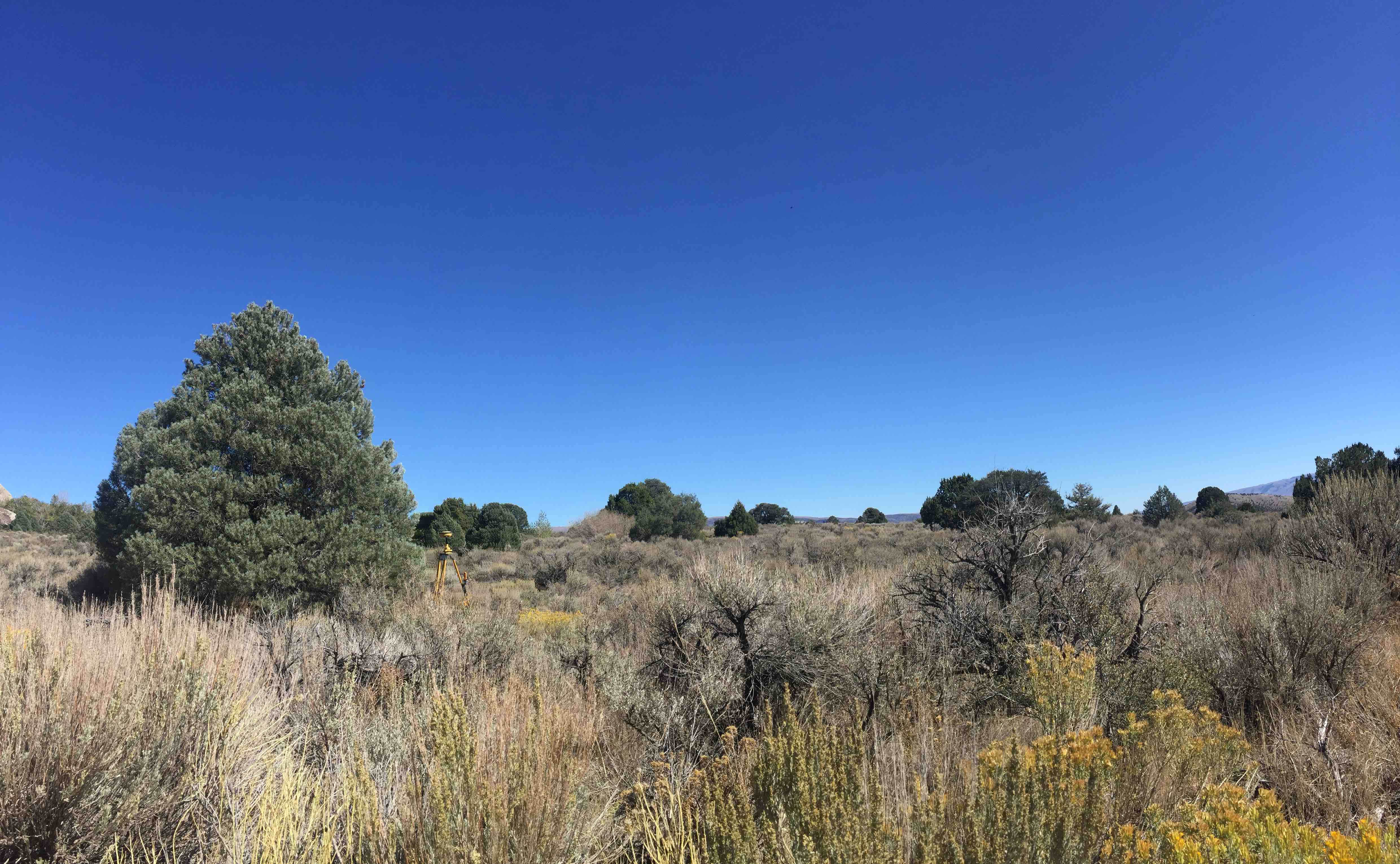
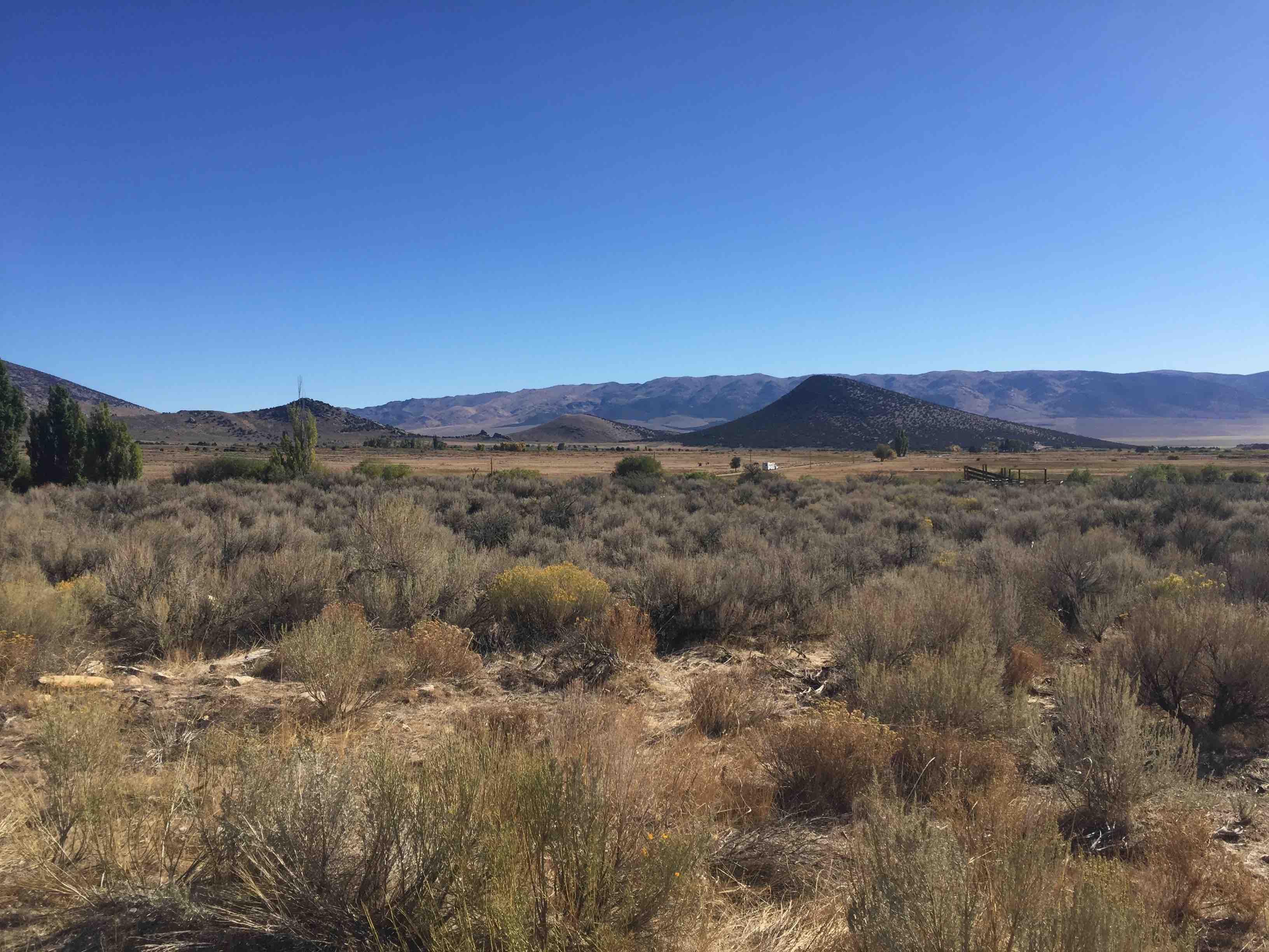
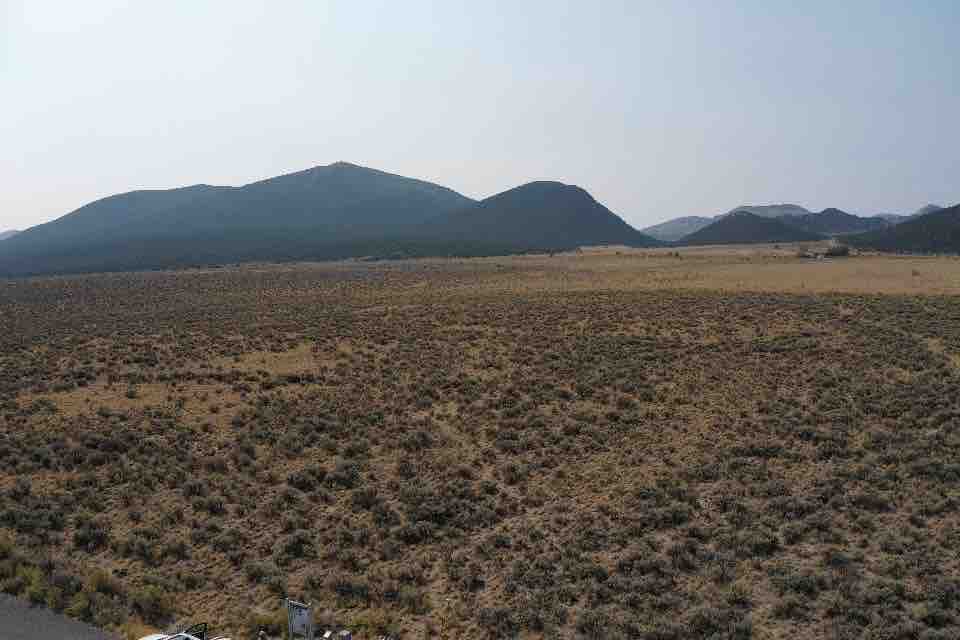
These data are part of a larger collection (<a href='https://www.northwestknowledge.net/data/f02ebec6-646b-4b65-a658-85480b736c7d/readme.txt' target='_blank' rel='nofollow ugc noopener noreferrer'>README.txt</a>) of UAS imagery data and data products.The images used to make these data products were collected at and near Castle Rocks State Park, Idaho, in June 2021. A DJI Mavic 2 Pro with Map Pilot Pro software was used to capture imagery over four sites of interest. The imagery was collected in a crossgrid pattern at 40m above ground level; the resulting imagery have a ground resolution of 1cm/pixel. The images were processed and the products created in Agisoft Metashape Pro. All products are georectified and in WGS84 UTM Zone 12 N. The sites are located along an elevation gradient, ranging from 5,300-6,000ft. The vegetation in Site 1 is dominated about mountain big sagebrush (Artemisia tridentata spp. vaseyana), pinyon pine (Pinus cembroides), and juniper (Juniperus occidentalis). Site 2 and 3 contain a mix of basin big sagebrush (Artemisia tridentata spp. tridentata), rabbit brush (Ericameria nauseosa), and bitterbrush (Purshia tridentata). Site 4 contains Wyoming big sagebrush (Artemisia tridentata spp. wyomingensis).</div><div><br /></div><div><font size='3'><img alt='Site C1' height='600' src='https://www.northwestknowledge.net/data/f02ebec6-646b-4b65-a658-85480b736c7d/Site_Metadata/Site_Photos/cr_site1_lowres.jpg' width='600' /> <br />Site C1<br /></font></div><div><span style='font-weight:bold;'><br /></span></div><div><span style='font-weight:bold;'><img alt='Site C2' height='600' src='https://www.northwestknowledge.net/data/f02ebec6-646b-4b65-a658-85480b736c7d/Site_Metadata/Site_Photos/cr_site2_lowres.jpg' width='600' /><br /></span></div><div>Site C2</div><div><br /></div><div><img alt='SIte C3' height='600' src='https://www.northwestknowledge.net/data/f02ebec6-646b-4b65-a658-85480b736c7d/Site_Metadata/Site_Photos/cr_site3_lowres.jpg' width='600' /><br />Site C3</div><div><br /></div><div><img alt='Site C4' height='600' src='https://www.northwestknowledge.net/data/f02ebec6-646b-4b65-a658-85480b736c7d/Site_Metadata/Site_Photos/cr_site4_lowres.jpg' width='600' /><br />Site C4<span style='font-weight:bold;'></span></div><div><span style='font-weight:bold;'><br /></span></div><div><span style='font-weight:bold;'>Recommended Citation:</span> Roser, A., Marie, V., Olsoy, P., Delparte, D., &amp; Caughlin, T. T. (2022). Unoccupied aerial systems imagery near Castle Rocks Idaho-2021 (Version 1.0) [Data set]. University of Idaho. <a href='https://doi.org/10.7923/Z23P-9444' target='_blank' rel='nofollow ugc noopener noreferrer'>https://doi.org/10.7923/Z23P-9444</a></div><div><br /></div><div>See the Data Processing Reports for each site (<a href='https://www.northwestknowledge.net/data/f02ebec6-646b-4b65-a658-85480b736c7d/June2021/Site_C1/CastleRocks_Site1_June2021.pdf' target='_blank' rel='nofollow ugc noopener noreferrer'>Site C1</a>, <a href='https://www.northwestknowledge.net/data/f02ebec6-646b-4b65-a658-85480b736c7d/June2021/Site_C2/CastleRocks_Site2_June2021.pdf' target='_blank' rel='nofollow ugc noopener noreferrer'>Site C2</a>, <a href='https://www.northwestknowledge.net/data/f02ebec6-646b-4b65-a658-85480b736c7d/June2021/Site_C3/CastleRocks_Site3_June2021.pdf' target='_blank' rel='nofollow ugc noopener noreferrer'>Site C3</a>, <a href='https://www.northwestknowledge.net/data/f02ebec6-646b-4b65-a658-85480b736c7d/June2021/Site_C4/CastleRocks_Site4_June2021.pdf' target='_blank' rel='nofollow ugc noopener noreferrer'>Site C4</a>) to learn more about camera location, camera calibration, and image overlap.</div><div><br /></div><div>Individual image tiles can be downloaded using the <a href='https://www.insideidaho.org/apps/imagery-explorer/' target='_blank' rel='nofollow ugc noopener noreferrer'>Idaho Imagery Explorer</a>.</div><div><br /></div><div>These data can be bulk downloaded from a <a href='https://www.northwestknowledge.net/data/f02ebec6-646b-4b65-a658-85480b736c7d/' target='_blank' rel='nofollow ugc noopener noreferrer'>web accessible folder</a>.</div><div><br /></div><div>Data are sourced from: <a href='https://doi.org/10.7923/Z23P-9444' target='_blank' rel='nofollow ugc noopener noreferrer'>https://doi.org/10.7923/Z23P-9444</a></div>\", \"distribution\": [{\"@type\": \"dcat:Distribution\", \"accessURL\": \"https://geocatalog-uidaho.hub.arcgis.com/datasets/uidaho::aerial-imagery-of-four-study-sites-within-castle-rocks-state-park-id-june-2021-1-cm-\", \"format\": \"Web Page\", \"mediaType\": \"text/html\", \"title\": \"ArcGIS Hub Dataset\"}, {\"@type\": \"dcat:Distribution\", \"accessURL\": \"https://insideidaho.org/arcgis/rest/services/imagery/castlerocksjune_2021/ImageServer\", \"format\": \"ArcGIS GeoServices REST API\", \"mediaType\": \"application/json\", \"title\": \"ArcGIS GeoService\"}], \"identifier\": \"https://www.arcgis.com/home/item.html?id=03ca7c06f7924700aa3a01bf22338d83\", \"issued\": \"2022-06-14T14:49:14.000Z\", \"keyword\": [\"aerial photo\", \"aerial photography\", \"air photo\", \"color infrared\", \"imagery\", \"nsf idaho epscor gem3\", \"ortho imagery\", \"orthoimagery\", \"orthophotography\", \"orthorectified imagery\", \"unoccupied aerial systems (uas)\"], \"landingPage\": \"https://geocatalog-uidaho.hub.arcgis.com/datasets/uidaho::aerial-imagery-of-four-study-sites-within-castle-rocks-state-park-id-june-2021-1-cm-\", \"license\": \"CC-BY 4.0 <a href='https://creativecommons.org/licenses/by/4.0/' target='_blank' rel='nofollow ugc noopener noreferrer'>https://creativecommons.org/licenses/by/4.0/</a>\", \"modified\": \"2024-03-06T21:28:35.000Z\", \"publisher\": {\"name\": \"University of Idaho\"}, \"spatial\": \"-113.6642,42.0829,-113.6375,42.1414\", \"theme\": [\"geospatial\"], \"title\": \"Aerial Imagery of Four Study Sites Within Castle Rocks State Park, ID (June 2021, 1-cm) \"}","source_transform":null,"status":"error"}
